In preparing for the 2015 PanAm games, Toronto is installing new signage to make the city an easier place to navigate. A wayfinding approach is being used which is defined on Wikipedia as: “ the ways in which people and animals orient themselves in physical space and navigate from place to place.” In addition to traditional maps, the wayfinding strategy uses multimodal approaches to make a city more “legible.” Landmarks, new media, public art, and street furniture are examples of ways the wayfinding strategy uses multimodalities. The project is currently being piloted in 21 locations around the Toronto.
Below are examples of Wayfinding signage in cities:
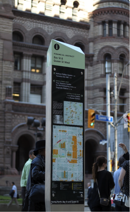

Brent Raymond, a partner at the design firm responsible for the new signage, commented on in the Globe and Mail on the wayfinding approach:
“It isn’t just about signs. It’s about helping people navigate space. The best examples are always places like airports. People who aren’t familiar with a place at all, they need to be able to find information quickly and feel confident about their environment.”
Read more about this approach to city living here:
